

Online data from the Matterhorn
At present, a network of sensors is recording data on freezing processes, rock movement, and on the temperature gradient in the permafrost area of the Hörnligrat ridge of the Matterhorn. In future, the wireless online monitoring could be used for risk management.
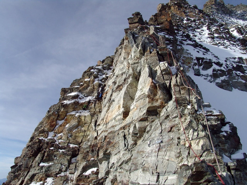
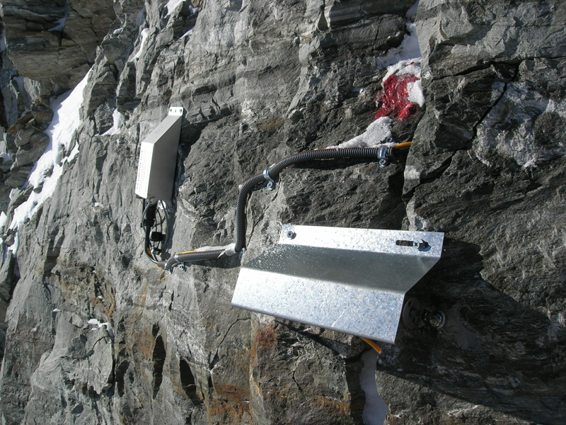
The small grey boxes are protected from falling rocks, avalanches, wind, and weather by little roof-coverings, a way of enabling them to resist the vile conditions on the Hörnligrat. The network of sensors installed by ETH Zurich, the universities of Zurich and Basel, and EPFL Lausanne in mid-July supplies important data facilitating the understanding of processes occurring in permafrost regions. The measuring technology used in the PermaSense program on the Matterhorn could free the way for a future real-time monitoring of areas vulnerable to falling rocks or landslides.
In the 2003 rock slide area
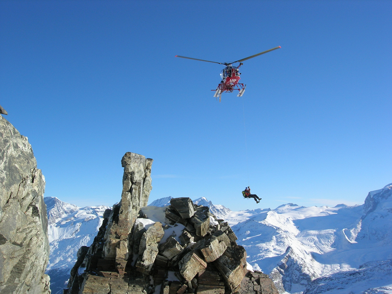
The measurement devices on the Matterhorn are installed in a region from which big quantities of rock broke off in the extraordinarily hot summer of 2003. “When I first rappelled down into this area, everything gave me the impression of being highly unstable”, recalls Jan Beutel, Senior Researcher at the ETHZ Computer Engineering and Networks Laboratory (TIK), a trained mountain guide and technical head of the joint PermaSense project of ETH Zurich, the universities of Zurich and Basel, and EPFL Lausanne. “After working in these surroundings for a while, you get used to the situation and do not experience it as drastic as before.”
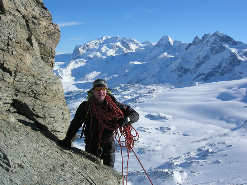
Still, climbing experience and no fear of heights are greatly advantageous for the project participants, who installed their measuring network onto the steep mountain face using ropes and hooks, and supported by helicopters. Holes of up to one meter deep were bored into the rock with the help of a cordless drill, and then fiber-glass tubes of 14 millimeters diameter, filled with probes and sensors, were inserted into the holes. There, they measure the ice and water pressure, the temperature within the rock and the crevices, and the movement of the crevices to see if and when they widen.
Miniature computers surrounded by falling rocks and avalanches
The different sensors are linked up by diverse cables to a tea-box-sized node fixed to the mountain face. A measuring and communication unit contains the sensor electronics, a matchbox-sized miniature computer with an integrated radio unit and a memory capacity of one gigabyte, as well as a special battery to keep the system working for at least three years. Beutel explains that, to ensure the functioning of the nodes for such a long time, the information is measured, registered and communicated, only for a fraction of a second, every two minutes. “All components have been designed and tested to suit the extreme conditions on the mountain with temperatures down to minus 40° C”
Avoid communication problems
The nodes are the heart of the network. Along with the necessary algorithms and software, these were developed by the teams of ETH Zurich, the University of Zurich, and the University of Basel. The existing 15 nodes convey their data to a central base station. By means of a cellular phone and the General Packet Radio Service (GPRS), this base station feeds the data into the Internet, to enable the researchers to monitor it permanently. According to Beutel, it was one of the great challenges to activate the cellular phone over the Internet: “Although, by now, the mobile Internet is widespread, a reliable communication in the reverse direction still lacks ready-made solutions”. Beutel and his team are responsible for the know-how concerning a reliable acquisition of data. “The data has to be absolutely correct, and nothing should be lost”. The scientists are still working on a manner of achieving and ensuring these aims in this extreme environment.
Probing the causes of permafrost
Computer scientists, electronics engineers, and geoscientists alike, profit from this interdisciplinary project. Stephan Gruber, Senior Assistant at the Department of Geography at the University of Zurich, and head geoscientist of the PermaSense project has been studying permafrost at high altitudes for years. Permafrost is the term for rock or soil which has a temperature of 0° C or less for at least two years. As the so-called active layer shows positive temperatures in summer, this surface layer is difficult to measure in models. In order to get a reliable model of the permafrost, authentic data is needed, something the researchers are aiming to get from their new measuring system.
Potential for effective risk management
With the new technology, the scientists aim to gain more accurate knowledge about some essential processes in permafrost regions, too. For example, on the exact processes occurring during changes due to frost action or the formation of ice in clefts and crevices and the movement caused by them. The researchers have already come up with some promising first findings, but an exact analysis will only be possible after a few months of continuous collection of data. Results are expected to show as from mid-June 2009, says Gruber.
A key factor for the success of the project is a well-functioning symbiosis between science and technology. For Jan Beutel and Stephan Graber, the interdisciplinary cooperation is of prime importance, as well as the good understanding of the other fields of study and of special applications. It is also essential to have nothing but absolute professionals working on this project. Should the team succeed in launching a perfectly reliable system, it could be used in many fields that require a risk management.
PermaSense
This project was instigated within the framework of the National Competence Center in Research Mobile Information and Communication Systems (NCCR MICS) and supported by the Federal Office for the Environment (FOEN). Its aim is to develop technologies that allow the monitoring pollutants, or complex and spread occurrences in nature with the help of a network of interlinked wireless sensors. PermaSense is just one of these projects included. In the long term, the applications are not restricted to the collection of scientific data but are also of importance in risk management.
|
|


READER COMMENTS